New map of the DGT with the state of the roads in real time
The Filomena storm these days has caused multiple cuts in the country's road network. I am sure that many of you have suffered from them, remaining unemployed at some point in the Spanish geography. The storm has been so important that the circulation of trucks has even been prohibited on many roads.
In this article we show you the best way to be fully informed about the state of the roads in real time. In this way you will know any affectation by storms, cuts due to works or accidents and you will avoid surprises on your route.
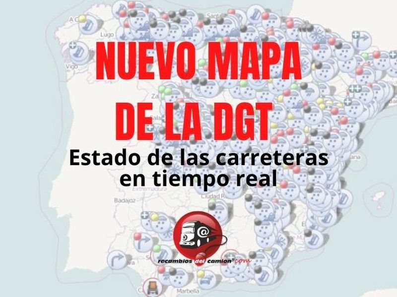
The DGT has recently launched a web page where the state of all the country's roads is reported in real time, through an interactive map.
In this map you will not only find information about cuts due to adverse weather conditions, but you will also see if your route will be interrupted by works, accidents or other types of detours or outages.
On the map you will find a series of icons that indicate, at each point, what type of incident has occurred. There are icons for the following incidents: traffic jams, smoke or dust, rain, ice, snow, wind, works, traffic accident or obstacle on the road.
The border of the circle that contains the icon tells you if it is a forecast (dashed border) or an incident in progress (continuous border).
You will also find the possible road closures marked by events such as a cycling race and the state of the road ports. In addition, restrictions are indicated for certain vehicles such as heavy vehicles, those that transport dangerous goods or special vehicles and/or those that require authorization.
In the upper left part of the icon you will find a colored dot that indicates the level of each incident:
• Black: Road closed. For meteorological incidents, the road is impassable for any type of vehicle and there is a clear risk of being immobilized on the road for long periods of time.
•Red: Very slow circulation with frequent and prolonged stops (circulatory congestion). For meteorological incidents, it indicates that the road is completely covered with snow, and circulation is only possible using chains or special tires, at a maximum speed of 30 km/h. This situation occurs more frequently in mountain passes. The circulation of articulated vehicles, trucks and buses is prohibited.
•Yellow: Slow circulation with sporadic stops. For meteorological incidents, it indicates that the road is beginning to be covered with snow, prohibiting the circulation of lorries and articulated vehicles at this level and that passenger cars and buses circulate at a maximum speed of 60 km/h.
•Green: Driving at moderate speed. For meteorological incidents, it indicates that circulation is not affected, although extreme caution should be exercised and it is recommended not to exceed a speed of 100 km/h on motorways and dual carriageways and 80 km/h on other roads. Trucks must circulate in the right lane and are prohibited from overtaking.
From Truck Parts we recommend you always carry chains in your vehicle to avoid surprises.
In our online store you will find textile chains, easier to place, for all vehicles: cars, trucks and coaches.
Other related articles
 Aug. 24, 2026
AI-powered cameras in Catalonia: Distraction controls on the A-2 and AP-7
For a professional driver, maintaining their license points and avoiding penalties is … Aug. 5, 2026
Solar eclipse 2026: traffic restrictions update
Traffic restrictions planned for the total solar eclipse on August 12, 2026, … July 22, 2026
2026 Solar Eclipse: Traffic Restrictions and Special Measures
The total solar eclipse of August 12, 2026, will be one of … July 10, 2026
Will breathalyzers be mandatory in 2026? Which vehicles are required to have them?
In recent days, numerous news reports have claimed that, from July 7, … June 15, 2026
Opinions of our clients
Receive our news